 English
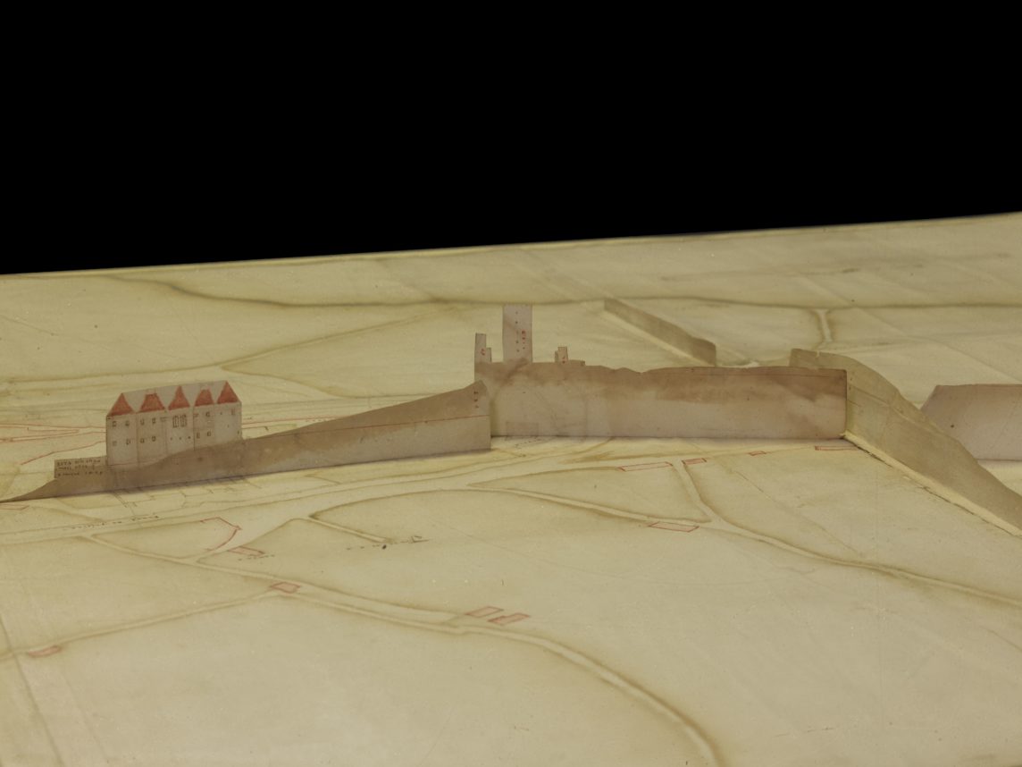
Since 2005, a plant in Guimarães, dating from the 16th century, has been found in Brazil, belonging to the collection of the Fundação Biblioteca Nacional do Rio de Janeiro [FBNRJ], integrating the volume “Mappas do reino de Portugal e suas conquistas collegidos por Diogo Barbosa Machado”. Among other characteristics, this map presents the plan of some of the most emblematic buildings of the city, such as the Castle, Paço dos Duques, Convent of Santa Clara and the Colegiada da Oliveira. There is also another remarkable feature, representing the relief of the city’s terrain through two raised and folding profiles.
The Casa de Sarmento has been developing a series of contacts with the Fundação Biblioteca Nacional do rio de Janeiro in order to give more visibility to this valuable cartographic set. Following these contacts, we learned of the recent restoration of the Guimarães plant. Through the images we receive, we can appreciate in a new perspective the city of Guimarães in the 16th century.